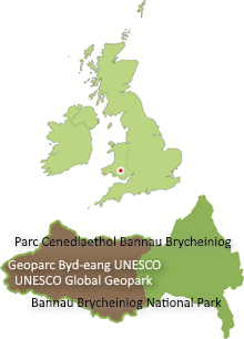
An earthquake occurred just outside the Geopark near the village of Cwmllynfell at 2.31pm on Saturday 17th February 2018. It was measured by the British Geological Survey (BGS) at magnitude 4.4 which makes it the largest to hit the British mainland since the Market Rasen Earthquake almost exactly ten years ago and the largest to hit this region since the Swansea Earthquake of 1906.
BGS have located the epicentre at 51.776 degrees north, 3.837 degrees west (Ordnance Survey grid reference SN 733102) beneath Mynydd Uchaf which is near the northern edge of the South Wales Coalfield. A number of geological faults have been mapped in the area; both numerous north-south aligned normal faults and also, a little to the southeast, the Swansea Disturbance, a major set of NE-SW aligned faults and folds. It is not known at this stage whether it was movement on one of the known faults that was responsible for this seismic event.


