


The National Park Visitor Centre above Libanus village is the start for various walks across Mynydd Illtud including a Geotrail over the common passing through Traeth Mawr nature reserve.
OS grid ref SN 978264 (National Park Visitor Centre/’Mountain Centre’)
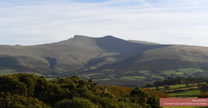
Mynydd Illtud is an extensive stretch of undulating common land owned and managed by Brecon Beacons National Park Authority. Sheep graze the pasture developed on thin soils which overlie rocks of the St Maughan’s Formation of the Old Red Sandstone.
An Iron Age hillfort is perched atop Twyn y Gaer at the north end of the common. Pillow mounds adorn its slopes. There are panoramic views over the Usk Valley to the north whilst the Brecon Beacons form a spectacular backdrop to the south.
Traeth Mawr and Traeth Bach are important wetland wildlife habitats and their peat deposits contain a valuable record of the climate of south Wales since the Ice Age.
Geology
- Old Red Sandstone (Devonian); St Maughan’s Formation
- Quaternary; moraines, ice-scoured plateau, peat deposits
Maps
- OS Landranger 160, Explorer map OL12
- Geological — BGS 1:50,000 sheet: 213 ‘Brecon’
Guides
- Mynydd Illtud Geotrail leaflet
- Mynydd Illtud Geotour – download the app to your smartphone for free from the Google Play or the App Store (search ‘Geotours’)
Facilities
- Restaurant, shop, toilets, displays, picnicking
- Pay & display car park at SN 978264
- Entry: free
Accessibility
- Common land; largely level; barrier-free but uneven surfaces;
Transport links
- By car — by minor road from A470 at Libanus
- By train — nearest stations are at Llandovery, Merthyr Tydfil and Abergavenny — see Traveline Cymru
- By bus — see Traveline Cymru; X43 service stops at Libanus (1.5 miles)
- By bike — can be reached by various minor roads, byways and bridleways