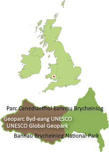
The British Geological Survey (BGS) publishes several maps at different scales which cover Fforest Fawr Geopark.
Geopark Map
Fforest Fawr: Exploring the landscape of a Global Geopark
The geology of the whole Geopark in one attractive and informative map. This special simplified 1:50,000 scale map showing the bedrock geology of the whole of Fforest Fawr Geopark together with inset mapping of the superficial geology at 1:100,000 scale, was published by BGS in 2014. It incorporates updates to the standard published maps described below.
Pop it in your pocket when exploring the area or display it on the wall. The map is available for £6.95 from Brecon Beacons National Park centres, the BBNPA online shop and the BGS online shop. It comes in a protective plastic wallet and provides extra detail on the area’s caves, waterfalls and quarries.
Regular 1:50,000 scale maps
Four sheets of the ‘England and Wales’ series of geological maps are required to give complete coverage of the Geopark.
- No.212 Llandovery (published 2008)
- No.213 Brecon (published 2005)
- No.230 Ammanford (2 versions available – see below) (published 1977)
- No.231 Merthyr Tydfil (2 versions available – see below) (published 1979)
These appear in blue covers and are available at £12.00 each. Sheets 212 and 213 are also available as parts of packs which contain ‘sheet explanations’; brief accounts (about 38 pages) of the local geology. Both packs cost £18.00
Sheets 230 and 231 are available as ‘Solid with drift’ versions which show the bedrock geology and as ‘solid and drift’ versions which also show the superficial deposits such as peat, alluvium and glacial deposits. A ‘memoir’ describing the area covered by sheet 231 is also available.
*Coverage of the whole of the national park can be completed with sheet numbers 197 ‘Hay on Wye’, 214 ‘Talgarth’ and 232 ‘Abergavenny’.
All of these maps and more can now be viewed on-line via the ‘Maps Portal’ at the BGS’s website. A ‘Geology of Britain Viewer‘ is also available on the BGS website, offering zoomable geological maps of the country using the most recent survey data. Click on the maps for modern formation names, ages and geological interpretation.
1:250,000 scale maps
‘Rocks of Wales’
The bilingual sheet ‘Rocks of Wales / Creigiau Cymru’ showing the bedrock geology of the whole country was published in 1994. It appears in a green cover and is available at £12.00.
‘South Wales Hydrogeological Map’
This specialist map at 1:250,000 scale covers aspects of groundwater availability, exploitation and quality. Published by the British Geological Survey in 1986, it is available from BGS at a cost of £12.50 in either flat or folded form.
Visit the BGS map shop online.
British Mountain Map of Brecon Beacons
This 1:40,000 scale topographical map covers the whole of the Brecon Beacons National Park except for the Black Mountains in the east and some peripheral areas. On the reverse side is a ‘digital terrain model’ (DTM) coloured to show the main rock divisions within the area and this is accompanied by a detailed geological commentary. Available from Harvey Maps, the British Mountaineering Council and good outdoor shops. First published in spring 2011.


