


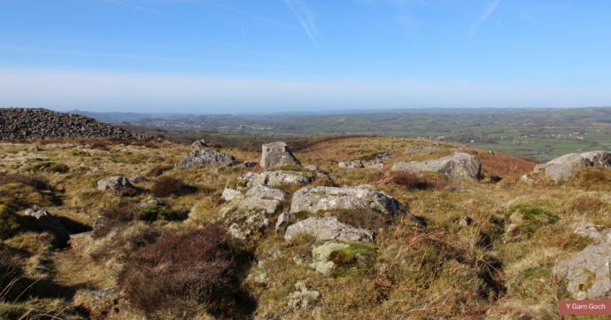
An area of open land crowned by the impressive remains of two Iron Age hillforts — Y Gaer Fawr and Y Gaer Fach — with evidence of Bronze age and Mediaeval occupation of the site too.
OS grid ref SN 690243
The Beacons Way passes through the site which is owned by Brecon Beacons National Park Authority. Splendid panoramic views across the Towy valley.
Geology
- Silurian: Ffairfach Grits and Llandeilo Flags (both sandstones)
Maps
- OS Landrangers 159 & 160, Explorer map OL12
- Geological — BGS 1:50,000 sheet: 230 ‘Llandovery’
Guides
- Garn Goch Geotrail leaflet
- Garn Goch Geotour – download the app to your smartphone for free from Google Play or the App Store (search ‘Geotours’)
Facilities
- Interpretive panel
- Free car parking at SN 682242
- Entry: free
Accessibility
- Uneven surfaces, barrier-free; open country
Transport links
- By car — on minor roads from village of Bethlehem.
- By train — nearest railway station is at Llangadog 4 miles / 7km to North — see Traveline Cymru
- By bus — see Traveline Cymru